Home
Become a Member!
Tour Of Lakes
TOL BLOG
TOL Short Route
TOL Medium Route
TOL Long Route
Club Rides
Ride Safe
Maps
Links
Contact & About
MAPS
We've got maps!
JOIN & GET ACCESS TO THE RIDE WITH GPS FILES TOO!
Brainerd/Baxter Cycle Corridor
Bob's BBQ Ride
Camp Jim
Crosslake Community Center
Crow Wing County Bike Routes
Crow Wing County is not flat
Crow Wing County average daily traffic count
Crow Wing County roads - average traffic less than 2000/day
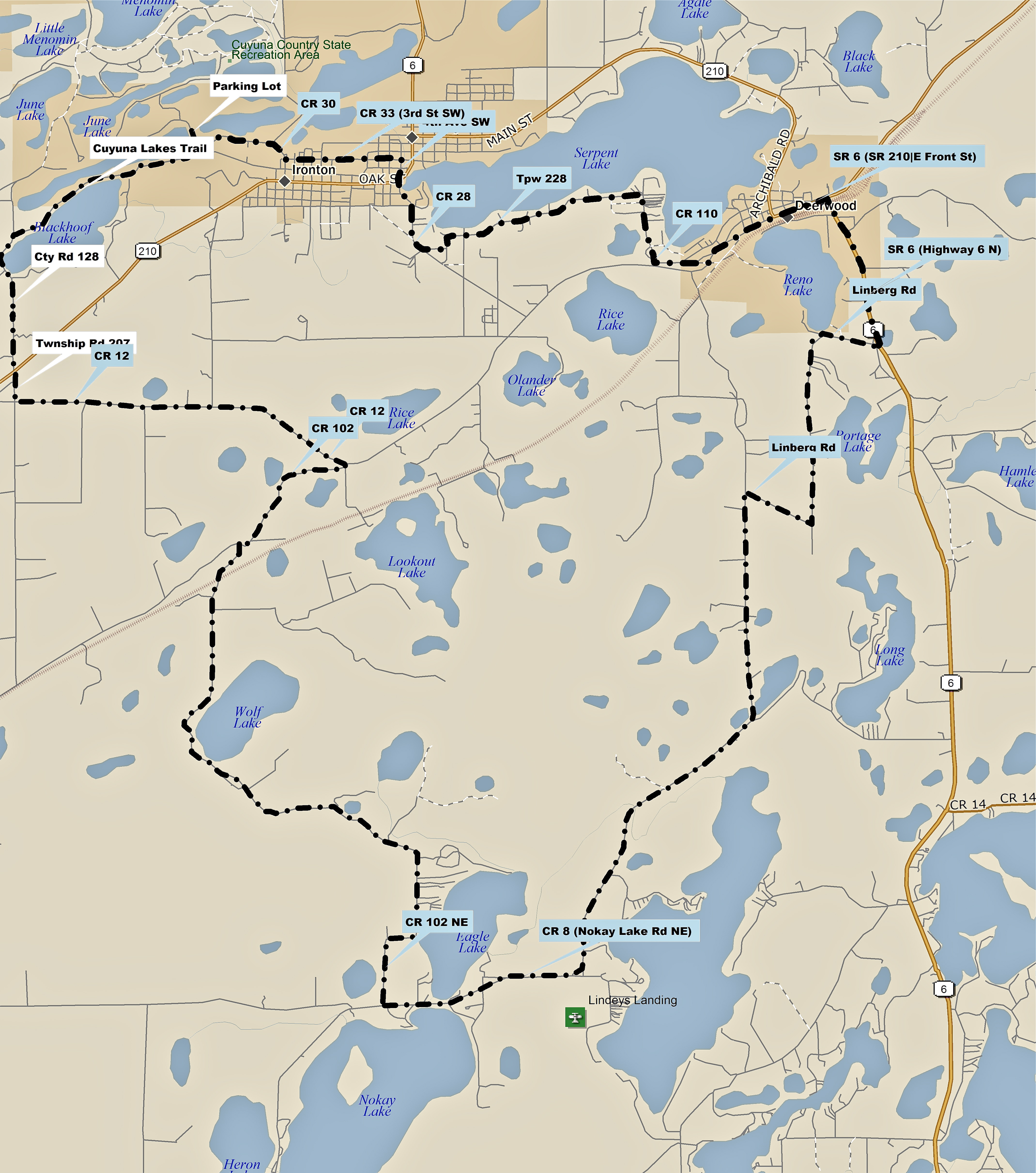
Cuyuna
Executive Acres & Legionville
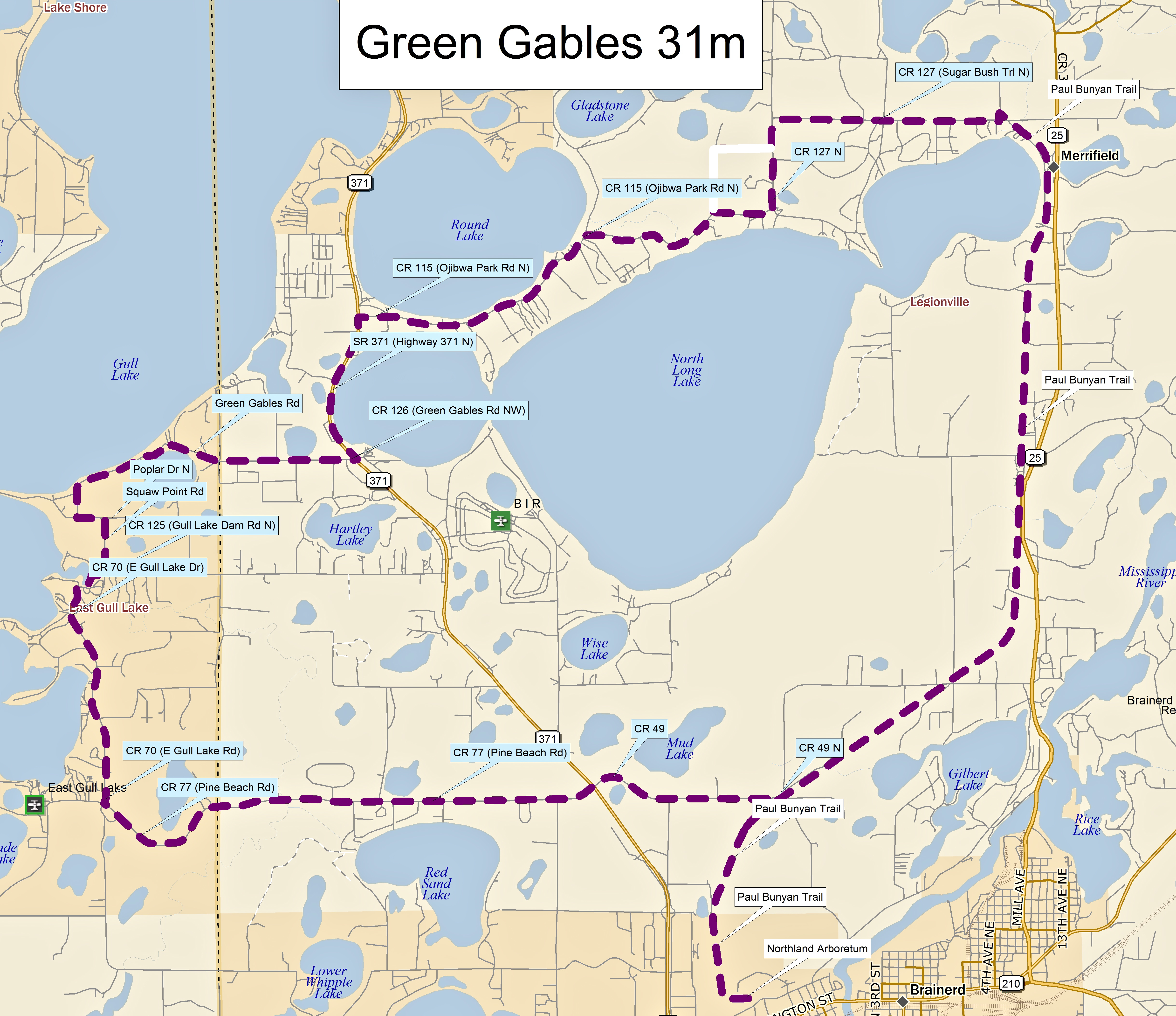
Green Gables
Gull Gallivant
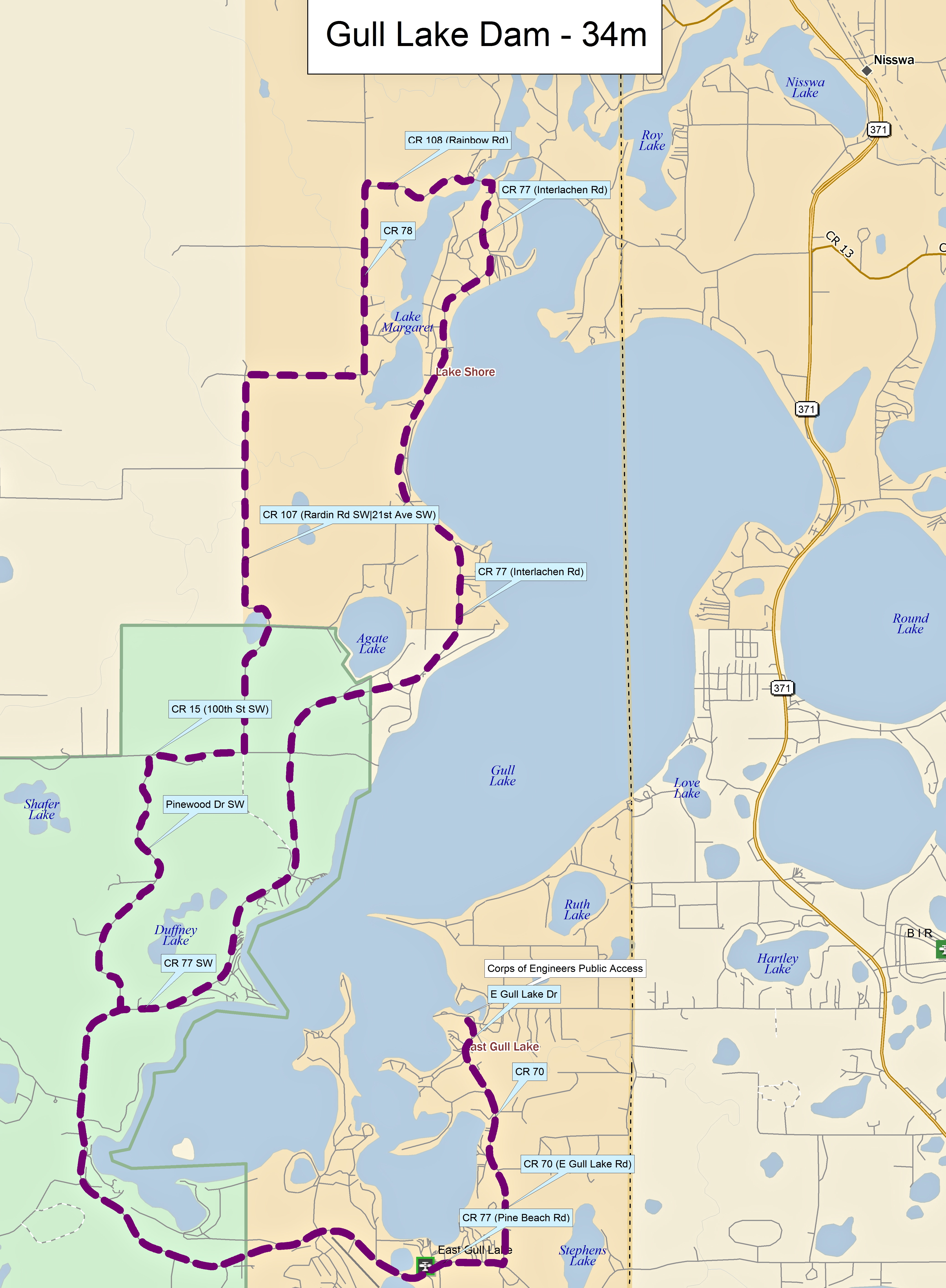
Gull Lake Dam
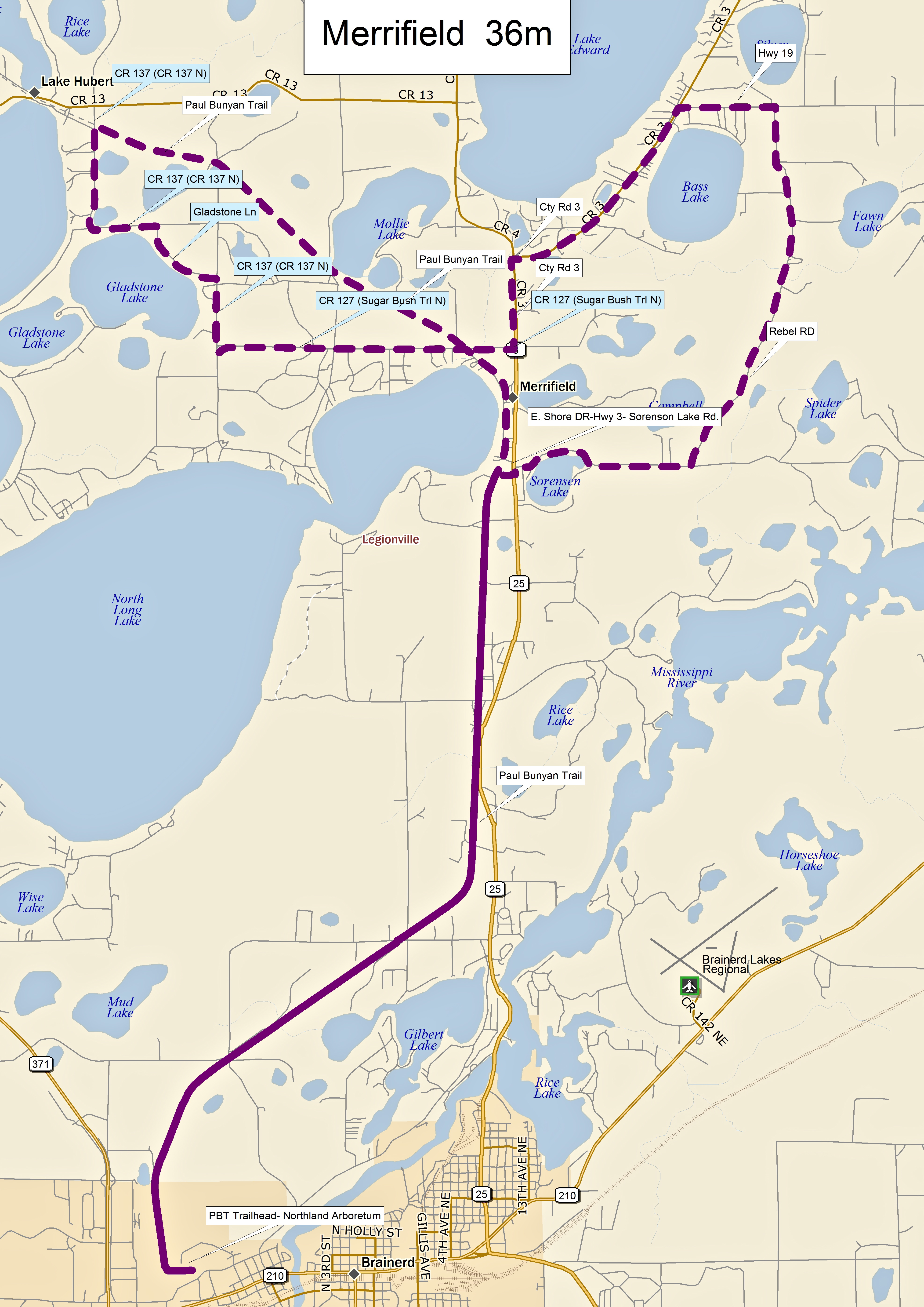
Merrifield
Mission Park - Pelican Lake 32mi
Nisswa Loops
Nisswa Merrifield
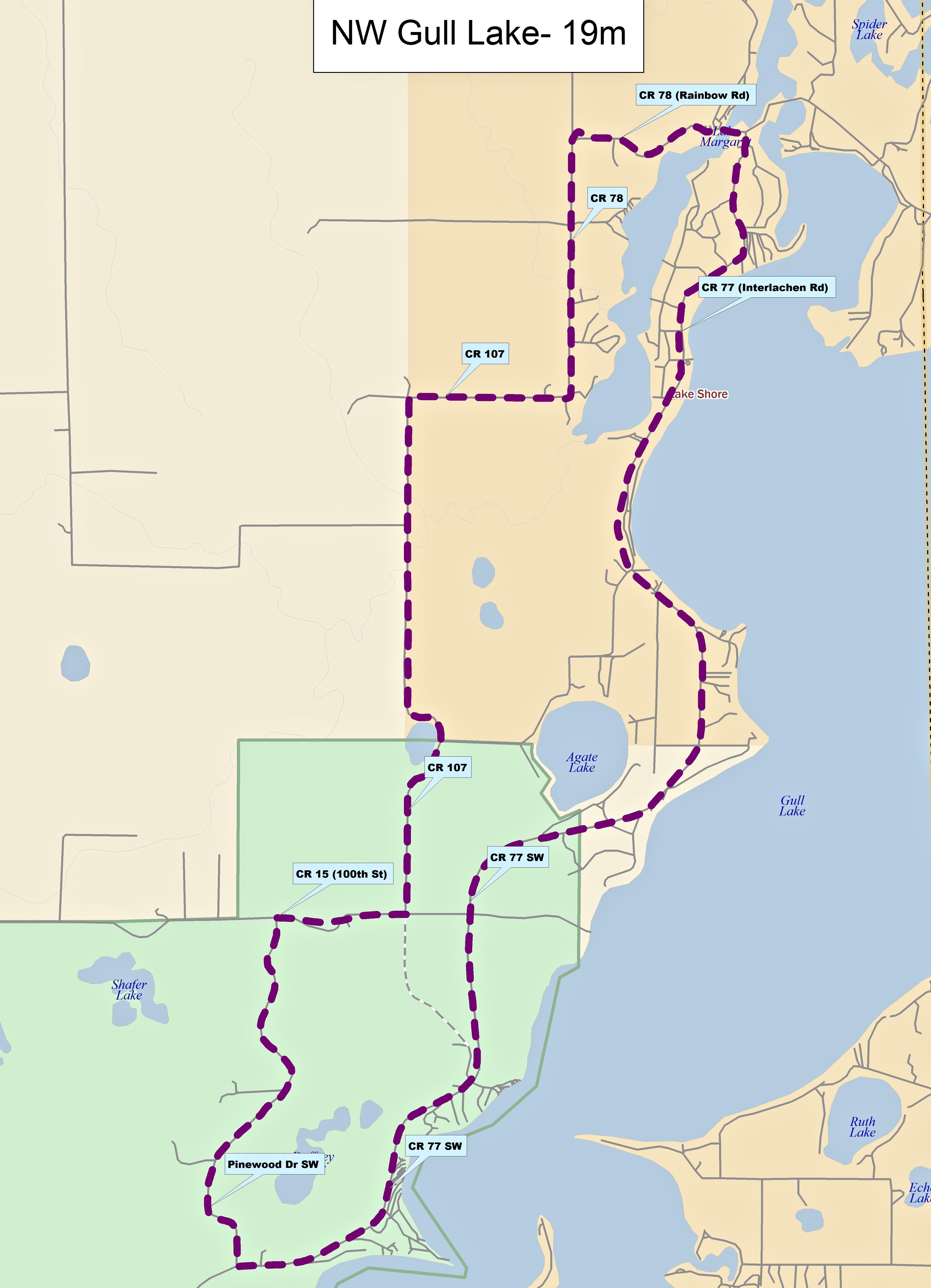
NW Gull Lake 19mi
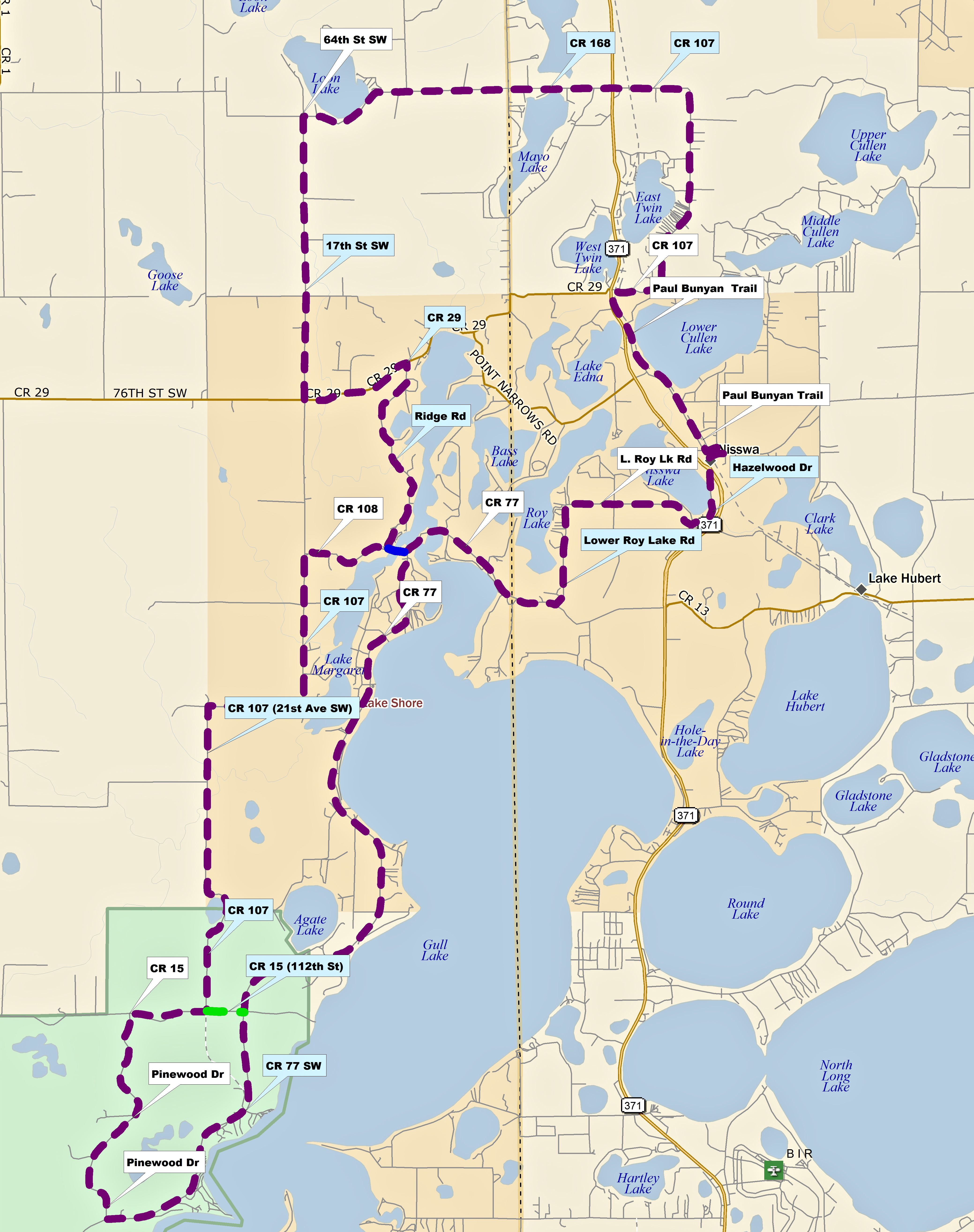
NW Gull Lake 38mi
Paul Bunyan Trail
- Baxter to Nisswa
Pequot Lakes Loop
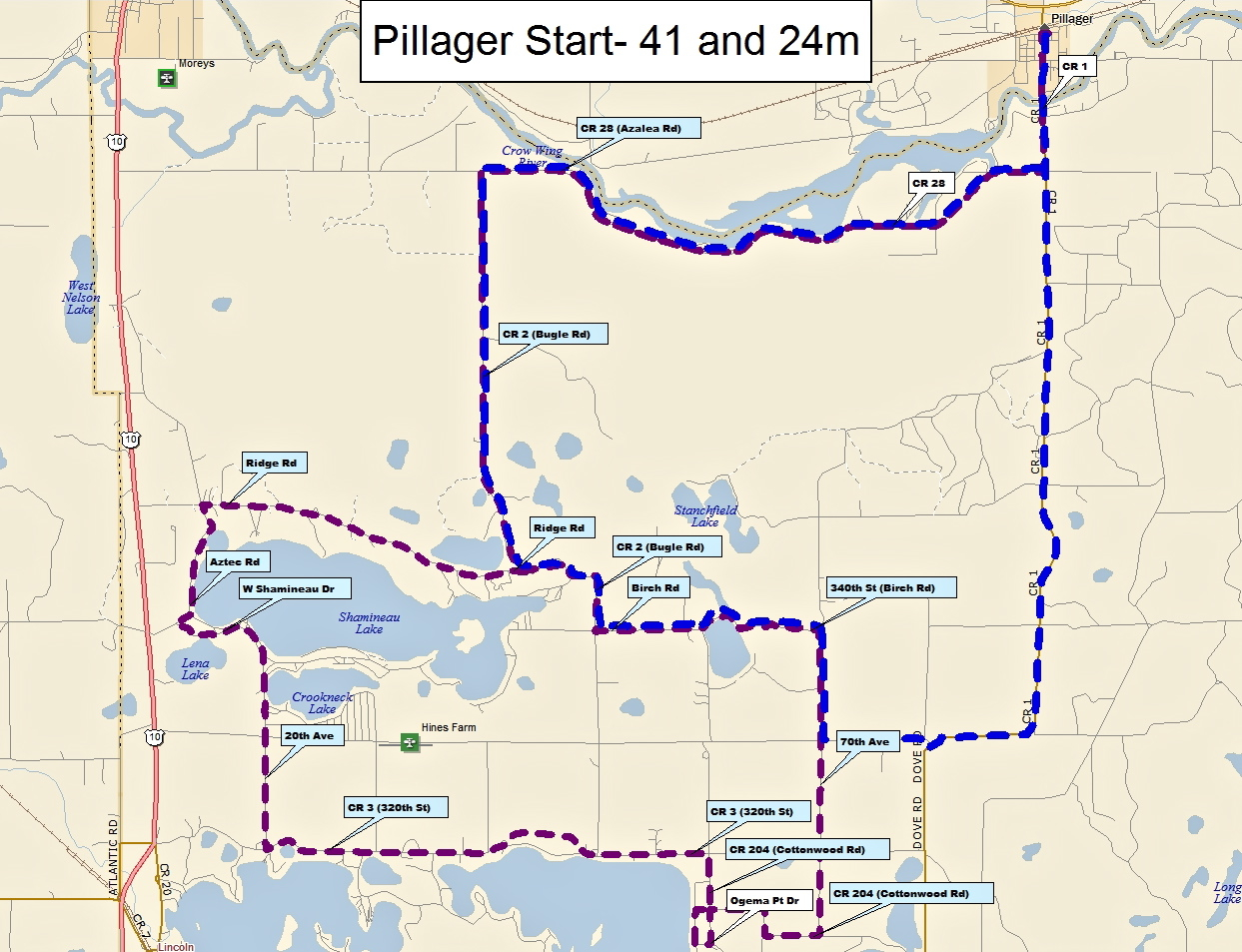
Pillager Start - 41mi and 24mi
Pillsbury Hills
Pine Center Birthday Routes
South Long Lake 26mi
Southeast of Lum Park 30mi
St. Mathias
Sylvan
Whipple Beach
Zigs
